Ground Penetrating Radar
Reliable Radar Scanning for Safer Digs
Get a Free Quote From Us Today!
We aim to get back to you in 24 hours.
At Ground Penetrating Radar, we specialise in ground-penetrating radar scanning and surveying services that enhance safety and efficiency. We use advanced radar technology to detect and map buried or concealed features.
Our services support various industries, including construction, archaeology, and utilities, providing crucial insights for safer excavation, drilling, and structural surveys. Contact us today to schedule a survey.
Who Is Ground Penetrating Radar?
We are experts in GPR scanning, delivering precise underground and structural investigations across the UK. Our commitment to cutting-edge technology ensures the accurate detection of hidden features such as pipes, cables, and voids. By using high-frequency electromagnetic waves, we provide detailed subsurface images that are crucial for construction planning and archaeological surveys.
Our equipment complies with BS EN 302066 standards, ensuring reliability and accuracy in each scan.
We work with a broad range of clients, from construction firms undertaking major infrastructure projects to archaeologists examining historical sites. Our services include precise depth analysis and material identification, helping to prevent costly damages and project delays.
Whether it’s a commercial property development or a public service utility installation, GPR scanning enhances project safety and efficiency. Contact us to discuss your requirements and see how we can assist your project.
What Services Does the company Ground Penetrating Radar Provide?
We offer a range of services tailored to meet the unique needs of our clients:
- GPR Scanning: Using high-frequency radar waves, we identify subsurface features across various terrain. This method is invaluable for construction planning, ensuring ground stability and detecting voids or buried debris.
- Structural Investigations: We examine buildings and other structures for anomalies, including the detection of reinforcement bars and concrete thickness. This is essential for restoration projects and verifying the integrity of older structures.
- Utility Detection: Locating and mapping utilities such as pipes and cables is crucial for preventing accidental damage during excavation work. Our GPR equipment can differentiate between metallic and non-metallic pipes, providing comprehensive utility mapping.
- Archaeological Surveys: Assisting in the identification of historical artefacts without excavation, we help preserve heritage sites. Our surveys can identify grave sites and ancient foundations, crucial for archaeologists and heritage conservationists.
Our experts are equipped with the latest radar technology to deliver reliable and precise results. Contact us to find out how we can support your project requirements.
When Is GPR Scanning Needed?
GPR scanning is essential before any ground-breaking activities, such as excavation or drilling, to avoid costly damages and ensure safety. This technology is particularly effective in detecting utilities, voids, and geological discrepancies that could pose risks during construction projects.
In archaeological research, GPR is used to map site features and locate buried artefacts without disturbing the soil layers, preserving historical integrity. In structural investigations, GPR helps assess the integrity of existing structures by locating rebar, post-tension cables, and conduits embedded in concrete, aiding compliance with structural safety standards.
Our services are valuable for projects requiring precise subsurface information, supporting a wide range of clients including construction companies, surveyors, and municipal authorities. Planning and executing successful projects with GPR can prevent unexpected site issues and promote efficient use of resources.
Contact us to discuss your project needs.
Get a Free No Obligation Quotation Today
How Does Ground Penetrating Radar Work?
Our process is meticulous and ensures comprehensive data collection:
- Site Assessment: We start by evaluating the site conditions and client requirements. This includes considering soil type, moisture content, and the presence of any surface obstacles that might affect the radar signals.
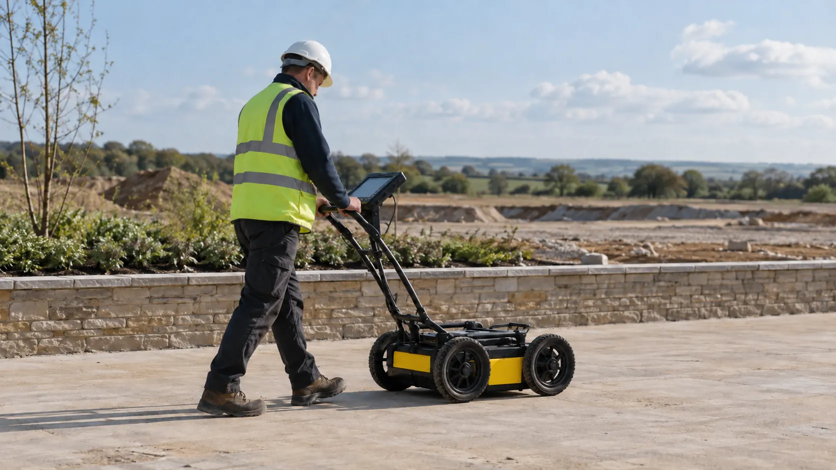
- Data Collection: We use specialised radar equipment, such as the GPR 3000 and RAMAC X3M, to survey the area in question. The equipment emits radar waves into the ground, capturing reflections from buried objects and different soil layers.
- Data Analysis: Our team interprets the radar data using software like RADAN or GPR-SLICE to identify subsurface features such as utilities, voids, and geological structures. We comply with standards like PAS 128 to maintain accuracy.
- Reporting: We deliver a detailed report with findings and recommendations. Our reports include 2D and 3D visualisations and are used by construction, archaeological, and environmental clients for informed decision-making.
Our GPR service ensures precise locating to assist in planning and avoiding potential disruptions.
Who Does Ground Penetrating Radar Help?
We assist a wide range of industries, including construction companies planning new developments, utility providers needing accurate infrastructure mapping, and archaeologists conducting site evaluations. Additionally, environmental consultancies benefit from our services to assess subsurface conditions and identify contamination zones.
Our ground penetrating radar technology can penetrate various soil types and detect both metallic and non-metallic objects, making it ideal for military applications requiring the detection of unexploded ordnance. Our expertise supports projects of all sizes with high precision and reliability, ensuring compliance with national standards like PAS 128 for utility detection and mapping.
Whether it’s a large-scale urban construction or a small archaeological dig, our services ensure thorough subsurface analysis. Contact us to see how we can support your specific needs.
How Quickly Can Ground Penetrating Radar Respond?
Depending on the project size and location, we typically respond to enquiries within 48 hours. Our team is equipped to handle urgent requests and often arranges initial consultations promptly, ensuring that project timelines remain on track.
We employ state-of-the-art radar equipment that allows for swift mobilisation and accurate data collection.
For complex projects, such as motorway infrastructure assessments or detailed archaeological surveys, we engage with clients early in the planning stages to align survey schedules with broader project deadlines. Our flexible scheduling options help us meet varied client needs, from construction firms to environmental consultants.
Get in touch with us to discuss your project requirements and discover how we can assist with your specific timelines.
How Does Ground Penetrating Radar Ensure Quality and Compliance?
We conduct our surveys in accordance with industry standards, ensuring the highest level of accuracy and compliance. Our operators are skilled in using the latest radar technology, such as the GSSI UtilityScan and the Mala CX12, following best practices and stringent safety regulations.
Our equipment offers high-frequency antennas that can detect buried objects up to a depth of several metres, allowing us to provide precise subsurface imaging for various project requirements.
For each project, we start by performing a site assessment to determine the best deployment strategy. This involves considering the soil type, potential underground utilities, and environmental conditions.
We adhere to PAS 128 standards for utility detection surveys and ensure all findings are clearly documented in detailed reports. Our attention to detail ensures that our results are reliable and can assist in informed decision-making.
Contact us to learn how our services can assist your project.
Request a free quote
Why Choose Ground Penetrating Radar?
We provide reliable results and a client-focused approach, making us the ideal partner for your subsurface exploration needs.
- Expertise: Our team is skilled in advanced GPR technology and underground surveys, using 400 MHz to 2.3 GHz antennas for various penetration depths and resolution.
- Accuracy: We employ precise methods such as time-domain and frequency-domain data analysis to ensure reliable results, guided by BS 5930 standards for subsurface surveys.
- Support: We offer ongoing assistance and detailed reporting, including 2D and 3D imaging, enabling informed decision-making for engineers, architects, and property developers.
- Safety: We are committed to minimising risk in construction and excavation projects, identifying utilities and obstructions to prevent costly damages and improve site safety compliance.
Our services are particularly beneficial for projects ranging from commercial developments to residential constructions. Contact us to see how we can support your upcoming project.
Frequently Asked Questions
What is GPR scanning used for?
GPR scanning detects underground features, including utilities, voids, and structural anomalies. It supports safe construction planning and archaeological explorations.
How deep can your GPR scan?
Depending on soil conditions and radar frequency, our GPR can scan up to 3 to 4 metres underground, providing detailed subsurface images.
Is GPR scanning safe?
Yes, GPR scanning is a non-invasive and safe method for surveying, using electromagnetic waves to provide subsurface insights without causing disturbance.
How long does a typical GPR survey take?
Survey duration varies with site size, but most projects are completed in one to two days, ensuring minimal disruption and timely reporting.
Get a Free Quote
For expert ground-penetrating radar scanning and surveying services, reach out to our team.
speak with our team today
What People are Saying About Us
★★★★★
“Impressed with the team at Ground Penetrating Radar. Would happily use them again for any scan.”
Daniel Lowry
London
★★★★★
“Ground Penetrating Radar were far friendlier than I expected, and I came away feeling really delighted with them.”
Oliver Kaur
London
★★★★★
“We needed our site scanned before digging could start. The Ground Penetrating Radar team arrived on time and marked everything up, and I would recommend them.”
Marcus Bennett
London
★★★★★
“Ground Penetrating Radar made the whole visit completely painless. Wonderfully kind, patient people, and I would recommend them to everyone!”
Charlotte Thackray
London
Our Locations
We are proud to work nationally across the UK, allowing us to ensure we can provide services to you.
For a full list of counties we cover in the UK, see below.